Back to projects
Projects
Awards
Studio
Contact
Instagram
LinkedIn
See project gallery
Swipe
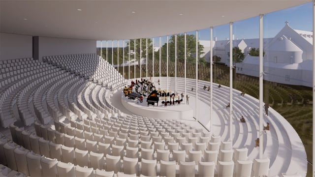
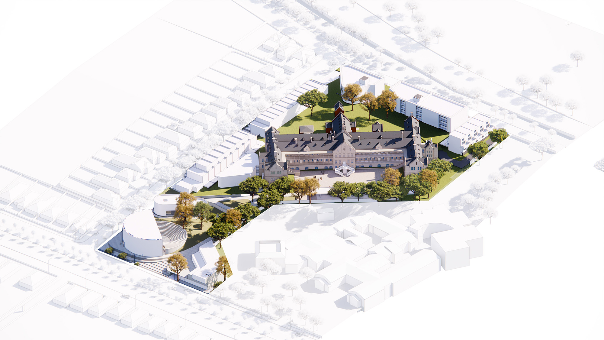
χώρα
Location
Northcote,
Victoria
Type
Cultural
Status
Coming Soon
Client
Greek Orthodox Archdiocese of Australia
Key Personnel
Billy Kavellaris
Rodrigo Sandoval M.
Mitch Stewart
Sean Yeo
Feidhlim O'Neill
Ken Poon
Previous
Victoria Square - Stage One
Next
Marcus Clarke
χώρα
Location
Northcote,
Victoria
Type
Cultural
Status
Coming Soon
Client
Greek Orthodox Archdiocese of Australia
Key Personnel
Billy Kavellaris
Rodrigo Sandoval M.
Mitch Stewart
Sean Yeo
Feidhlim O'Neill
Ken Poon